About

In this project, termed SPARCLE, researchers are working to identify conservation priorities that consider information about future climate change and development for agriculture and energy. This work includes both a global analysis and regional work in Colombia.
This project builds upon a previous GEF-funded Conservation International project called Spatial Planning for Conservation in Response to Climate Change, or SPARC (www.sparc-website.org). In SPARC, researchers modeled species shifts under climate change for over 17,000 species of amphibians, birds, mammals, and reptiles. These models illuminate areas of conservation importance to protect species based on not only where they are now, but where they may need to shift under climate change.
However, there are many factors at play in determining where conservation could occur for the best benefits for biodiversity, carbon, and other natural assets. In the SPARCLE project, we bring in additional information on where land is needed for future food and energy production to accommodate for growing human population and consumption. More land is likely needed for agriculture and renewable energy development, but these land uses can come into conflict with natural areas. We aim to answer the question, how do we best allocate land for agriculture, food, and energy to support humans and biodiversity?
Giant Anteater (Myrmecophaga tridactyla)
© Pete Oxford/iLCP
This project will support spatial planning in response to climate change by completing the following objectives:
Perform global analyses to identify where strategic land use planning for conservation, agriculture, and energy can support humans and biodiversity under climate change.
Perform focal region analysis and directly engage with experts and stakeholders in the area to support decision making.
The global and regional analyses will incorporate projections of biodiversity, agriculture, and energy into spatial prioritization algorithms to identify risks and opportunities due to the interaction of shifting natural habitat and the human landscape. This type of integrated spatial planning for multiple sectors can help countries meet international commitments and ensure their conservation investments are sustainable.
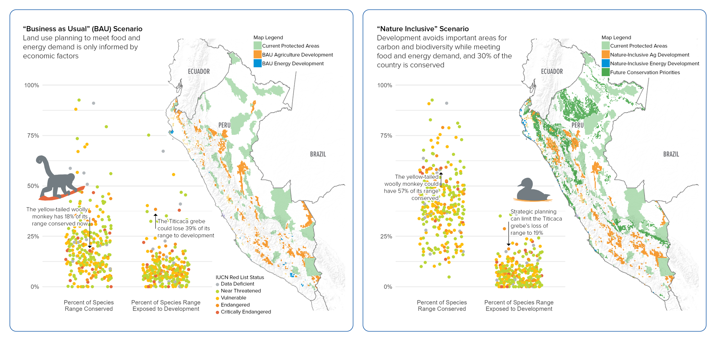
Below are preliminary results based on global data with Peru as an example. This figure illustrates two scenarios: First, a “Business as Usual” scenario, in which land use planning to meet food and energy demand is only informed by economic factors, and second, a “Nature Inclusive” scenario in which development avoids important areas for carbon and biodiversity while meeting food and energy demand, and 30% of the country is conserved to align with 30x30 goals.